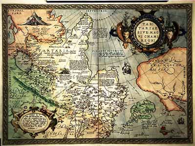
- Tartariae sive magni —hami Regni typus. [Antverpiae, 1570].
Maps and bibliographical description
|
In catologue |
 |
S I B E R I A M A P P I N G Maps and bibliographical description
- Tartariae sive magni —hami Regni typus. [Antverpiae, 1570].
The first printed map of Siberia. A map from the atlas "Teatrum orbis terrarum"(Antwerp, 1570) is made up by A.Ortely For a whole century after this map has been published (i.e., before the appearance of the map of Siberia made up by N.Witsen in 1687), west European mapping of Siberia did not reach any appreciable results.
In catologue