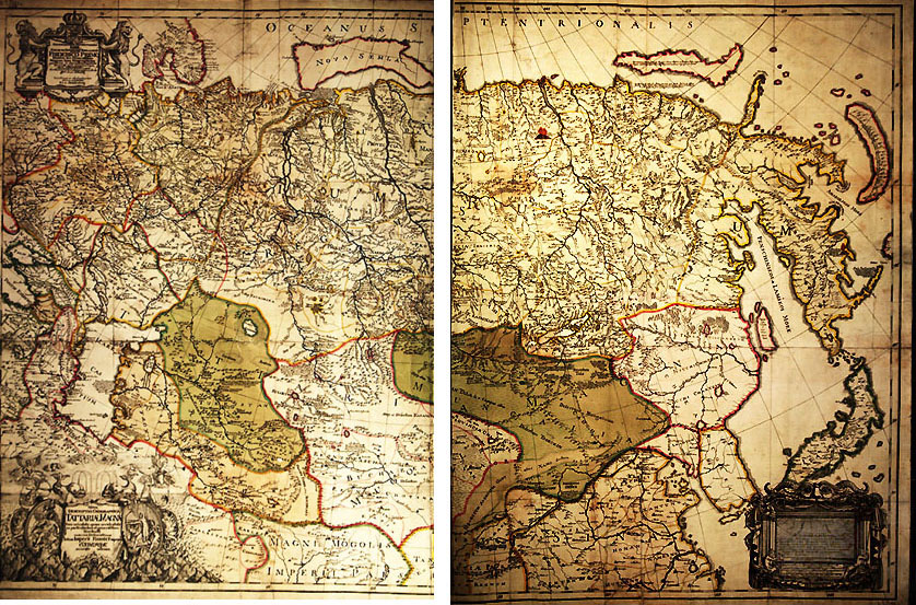
Nova
Descriptio Geographica Tartariae Magnae tam orientalis quam occientalis
in particularibus et generalibus Territoriis una cum Delineatione totius
Imperii Russici imprimis Siberiae accurate ostensa [Philipp-Johann V. Strahlenberg,
T.A.Matern, P.F.Frisch, sculpsit. Paris, 1725].
1 sh. 63x98 (75x105). Engrav. Colour.
Map of Russia (New geographical description of Tartar).
The map is made up by Philipp Strahlenberg (F.Tabbert), captive Swedish
officer which lived in Tobolsk from 1711 to 1721. Materials from S.U.RemesovÆs
atlas and other private maps of Siberia were used to make it up. It was
published for the first time in 1725 in Paris, and in 1730 in Stockholm
as a supplement to the book by Strahlenberg Das Nord und Ostliche Their
von Europa und Asia. There are many uncertainties in this map, and the
materials of the First stage of the Second Siberian-Pacific expedition
have not been taken into consideration. However, Strahlenberg gives much
new information as compared with general maps of Siberia made up by other
authors. Though imperfectly he shows Chukchi Peninsula, Kamchatka and gives
more exact contours of Caspian Sea detached from Aral Sea etc.
In catologue
|
|